ASPHALT
moderate

Stage 1
ARBIZU - PUENTE LA REINA
Distance: 105 / 76 km
Unevenness: 1.460 / 1.230 m
2 COLS, Lizarraga and Genbe first, and the Arakil basins and Arga after. Stages without excess and smell of South.


The first stage of FUENTES del VINO allows us to proceed on to business calmly. It is even possible, if we used the morning for the trip by car to Arbizu, to do the tour in an afternoon.
Without long stops 5 long hours will be sufficient to reach Puente La Reina
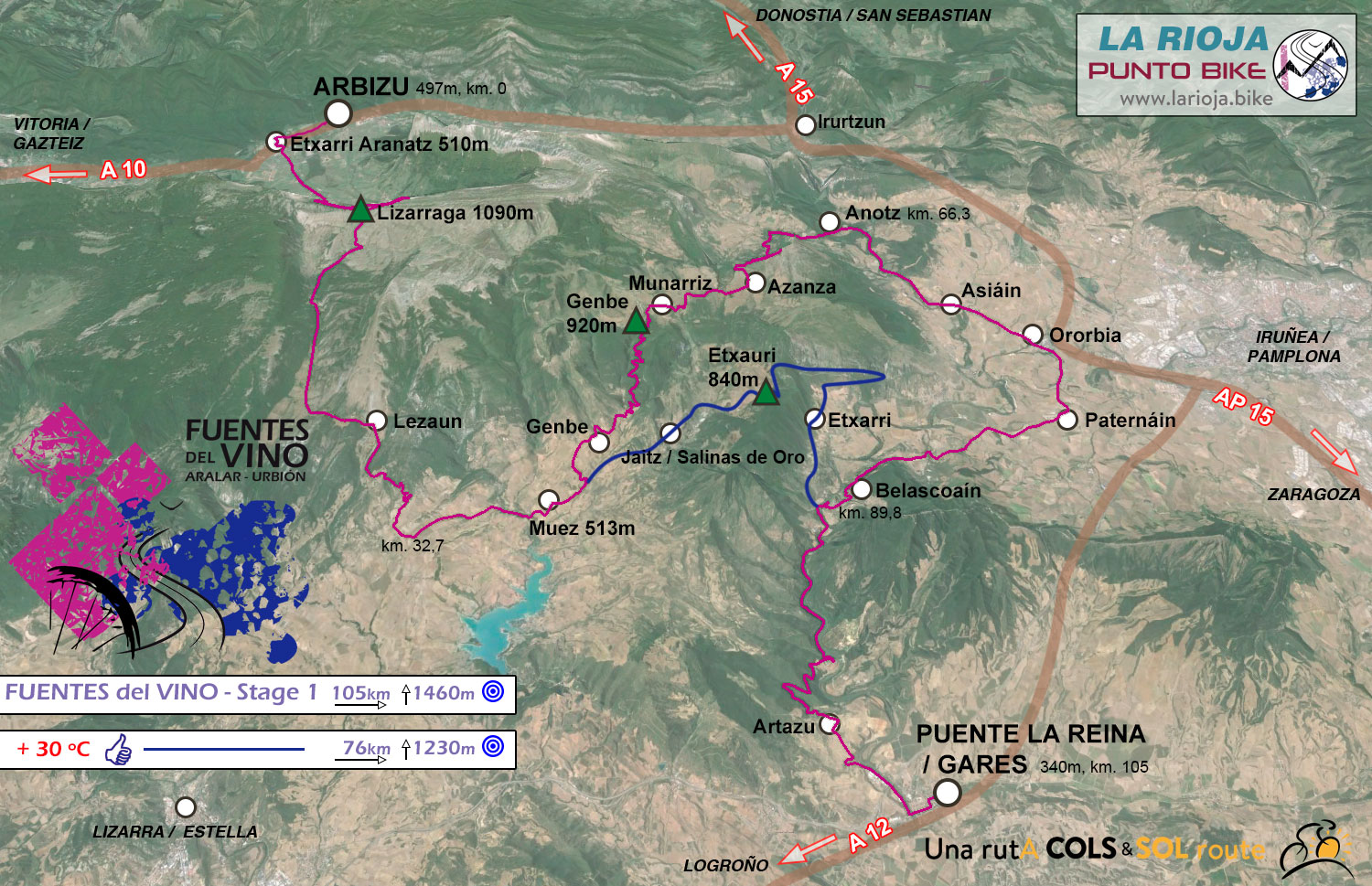
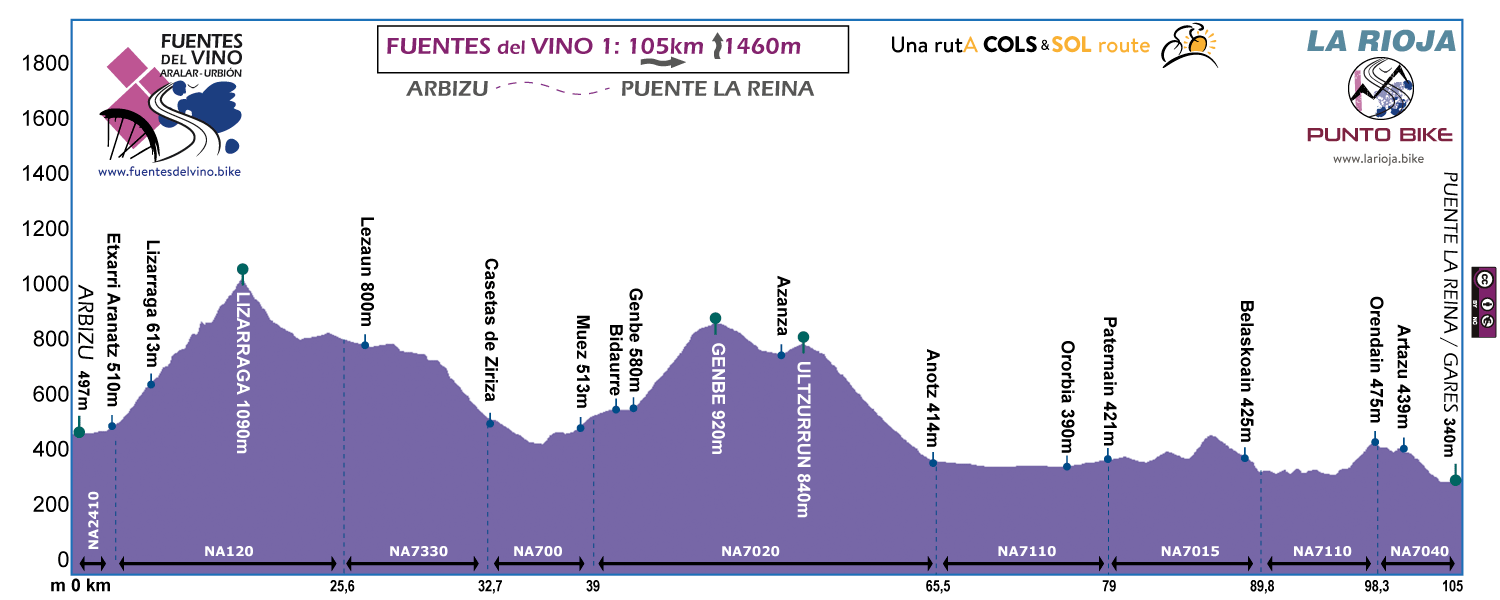

The vision of the Beriáin from Arbizu will be our hostess in FUENTES del VINO.

Ascending Lizarraga. The Sakana Valley is going more and more down.
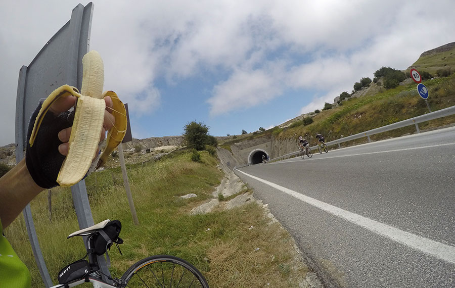
Filling tanks after topping the Lizarraga mountain pass.

Descending through forest - Genbe mountain pass towards Azanza.

Ascending Argiñariz - FUENTES del VINO PLUS - At the end of the Valley, the Arga flows looking for Puente La Reina.

Font and old laundry in the vicinity of Argiñariz, almost "obligatory" stop - FUENTES del VINO PLUS -

End of stage, Puente La reina and its medieval bridge (11th century).
 Return
